The UK Civil Aviation Authority authorise 70km of BVLOS flights – unlocking safer, smarter, and more efficient rail infrastructure management.
Moving Beyond Trials to Full Operations
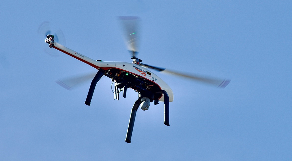
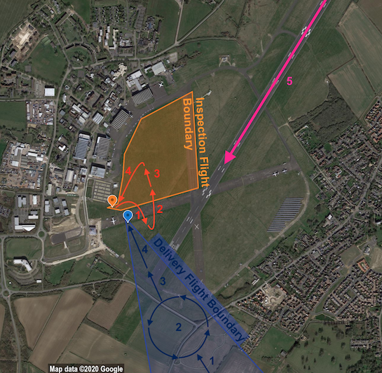
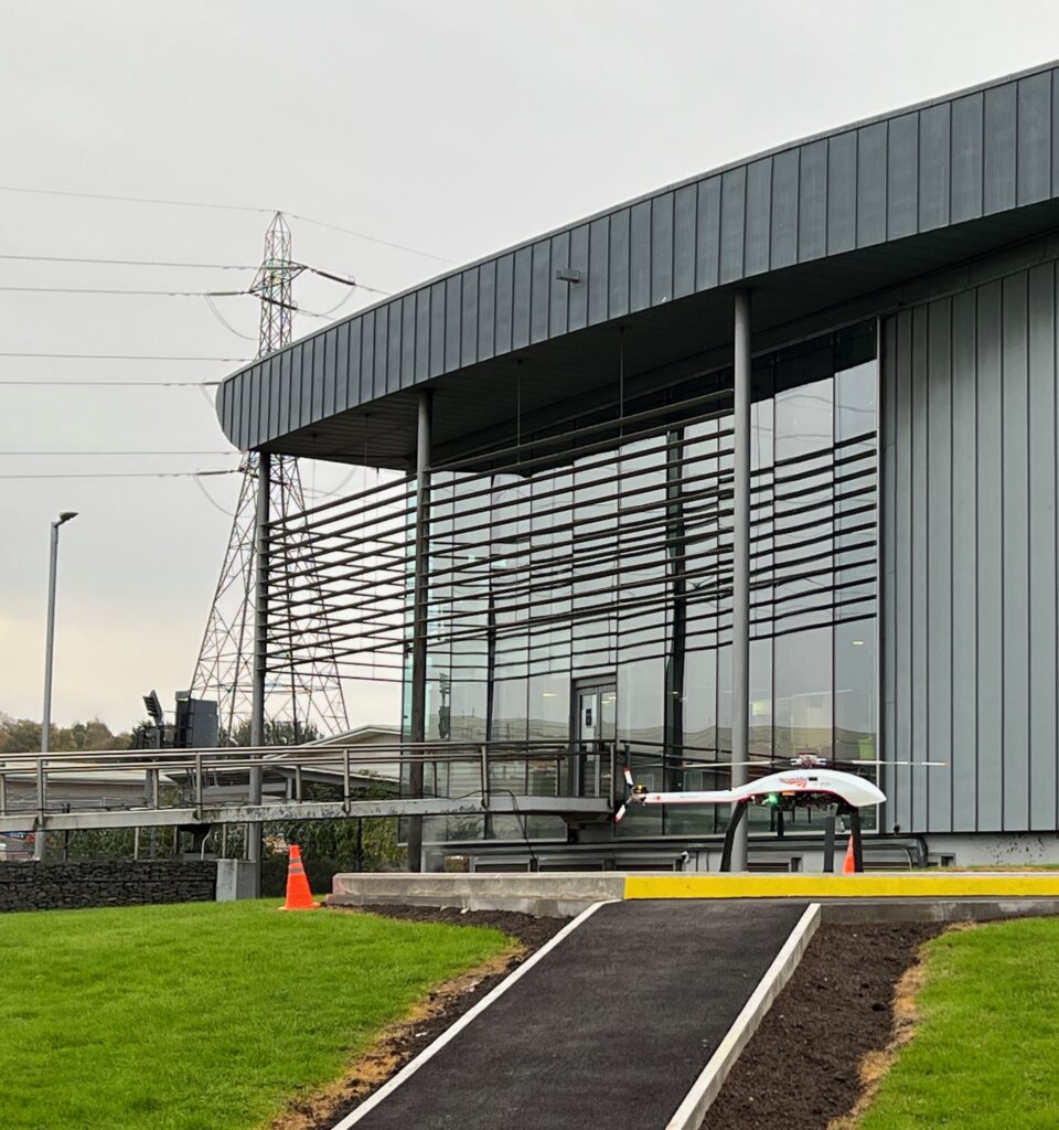
Dronecloud and RUAS (Railscape’s UAS division), working with manufacturer Velos Rotors, have secured approval from the UK Civil Aviation Authority (CAA) to roll out Beyond Visual Line of Sight (BVLOS) flights across nine rail routes totalling 70km.
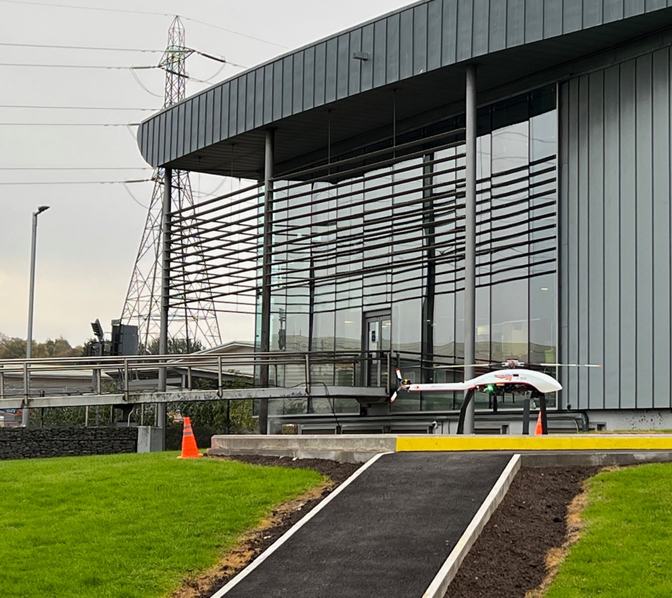
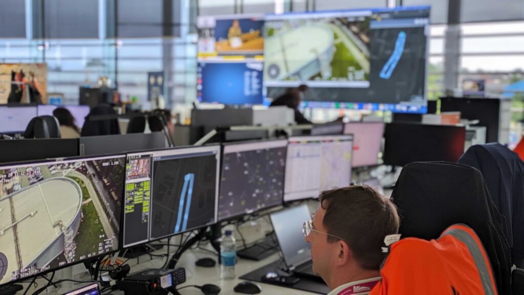
The flights will be operated from a purpose-built Drone Hub at Network Rail’s Birmingham Rail Operating Centre (ROC). Using Dronecloud’s pioneering Uncrewed Traffic Management (UTM) system alongside the UK Civil Aviation Authority’s Atypical Air Environment framework, and with skilled UAV pilots from RUAS, this authorisation paves the way for rapid expansion across Network Rail’s 14 routes and 20,000 miles of track.
Why It Matters
This approval is more than a milestone in aviation — it’s a breakthrough for Britain’s railway.
- Incident management has cost Network Rail over £1bn in the past decade.
- Trespass alone has caused 1.5 million minutes of delays since April 2024.
- Routine inspections are costly & time-intensive
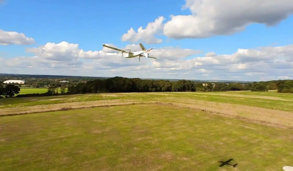
BVLOS operations allow drones to safely deliver large-scale, real-time monitoring and rapid response capabilities — reducing risk, cutting disruption, and enabling safer and more reliable services for passengers.
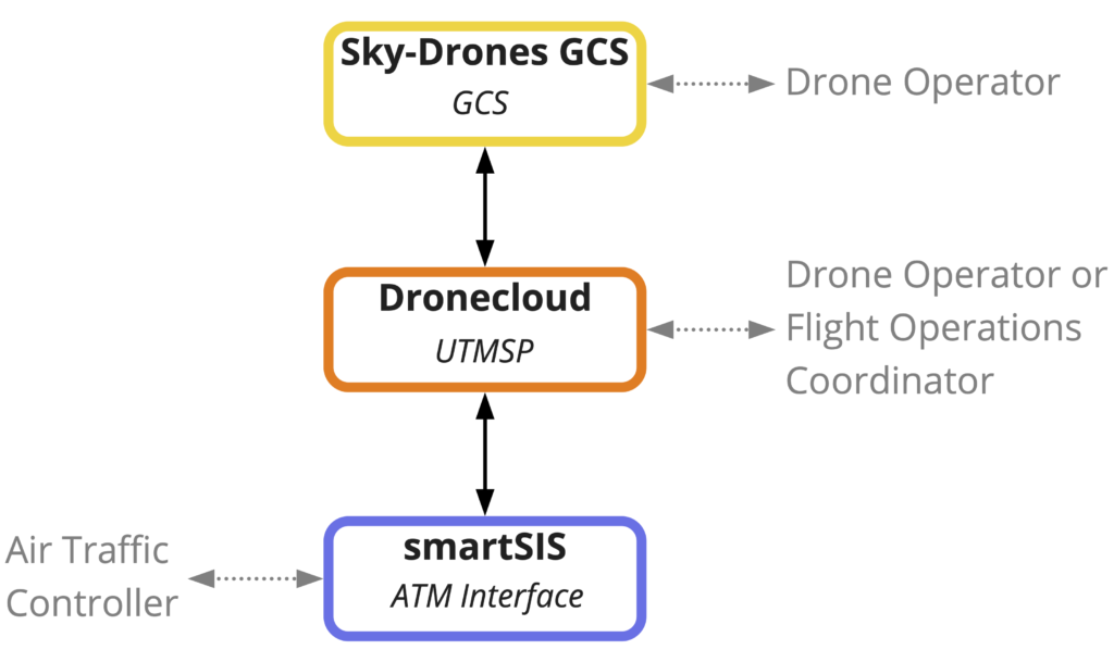
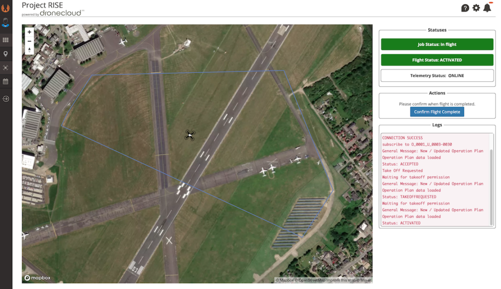
Dronecloud’s UTM: Enabling Safe Scale
Dronecloud’s UTM platform monitors flight conformance and ensures safe separation of aircraft, creating the conditions for BVLOS flights to be not only possible but scalable. This is the first UTM system in the UK proven at scale for Critical National Infrastructure (CNI).
Leadership Commentary
Simon Bachelor, Head of Drones Programme British Transport Police (BTP):
“We police Britain’s railways, providing a service to rail operators, their staff and passengers across the country. A key strategic objective is to innovate and collaborate with partners to reduce disruption, which is exactly what this project is about. We have been using drones for many years now and are using the latest ‘Drone In a Box’ technology to tackle disruption. What is clear is that we need a viable means of deconfliction with other air users and to progress an effective UTM to allow our operations to be conducted at scale.”
Jan Domaradzki, CEO, Dronecloud:
“Dronecloud’s vision is to help deploy managed services with multiple Hubs and satellite drones ports to deliver a common capability for all asset managers and drone operators needing to fly BVLOS across the UK. This will be a truly game-changing capability, opening the door for centralised mass-scale deployment of drones across all CNI (Critical National Infrastructure). As the industry matures, CNI use cases will help drive the design and development of UTM services. It’s critical for us to be at the forefront as we move into the implementation stage.”
Ed Lewis, Head of Operations & Strategy, RUAS (Railscape):
“The success of this BVLOS project hinges on strong collaboration, and as an operator, RUAS are proud to be part of this team effort with Network Rail, Dronecloud, and others. By working together and sharing expertise, we’re developing best practices and setting the standard for future BVLOS operations within the rail industry and beyond. This initiative is a game-changer, allowing us to move beyond the limitations of visual line of sight and offer significantly more efficient and extensive monitoring and response capabilities. Ultimately, this technology will enable Network Rail to deliver safer, more reliable rail services for the public.”
BVLOS is a Journey – This is Just the Start
This authorisation, granted under the UK Civil Aviation Authority ‘s Airspace Modernisation Strategy, represents the first step toward integrating drones into shared airspace at scale. Dronecloud, RUAS, Network Rail and Velos Rotors will continue working closely with the UK Civil Aviation Authority to evolve policy and maximise the benefits of BVLOS for industry and society.
Recognition of the Regulator
Delivering approval for BVLOS operations on this scale required unprecedented collaboration. Dronecloud and RUAS pay tribute to the UK Civil Aviation Authority teams — including Test & Evaluation, Future Safety and Innovation (FSI) Policy, Safety Operations Risk Assessment (SORA), and Remote Piloted Aircraft System (RPAS) Sector — whose work has enabled a clear and robust framework for safe BVLOS expansion.
Next Steps: Scale & Rollout
Dronecloud is now engaging with other Critical National Infrastructure partners to expand BVLOS operations across road, rail, maritime and power networks. This marks the beginning of a national shift toward drone-enabled infrastructure management.
Join the journey to scale BVLOS.
Organisations interested in partnering with Dronecloud, RUAS or the wider team are encouraged to get in touch.
A tribute to the UK Civil Aviation Authority – This was a shared accomplishment.
It’s not often that industry pays tribute to the work done by regulators. However, given the complexity and size of the safety case required to deliver this authorization, the efforts of the Test & Evaluation, FSI Policy, SORA teams, and specifically the RPAS Team must be acknowledged. The recent evolution of policy and accompanying guidance has been crucial to ensuring that as an industry we can invest in large scale, long-range BVLOS knowing that there is a clear roadmap evolving.
Dronecloud are only too happy as pioneers in this type of operation, to share data with the UK Civil Aviation Authority and actively help shape the evolution of future UAS policy.